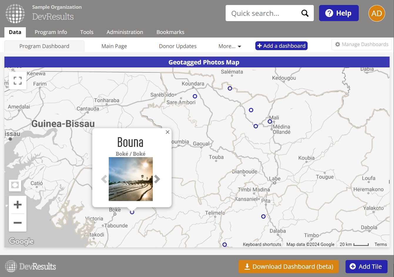
The Geotagged Photos Map tile allows you to display a map of photos on a dashboard. Interact with the map by:
- Clicking on a location or administrative division to see thumbnails of one or more photos associated with that place.
- Using the left/right arrows to scroll through multiple photos in a given place.
- Hovering over the photo to see its caption.
- Clicking on the photo to see a larger version, to see complete details for the photo, or to download a full resolution image.
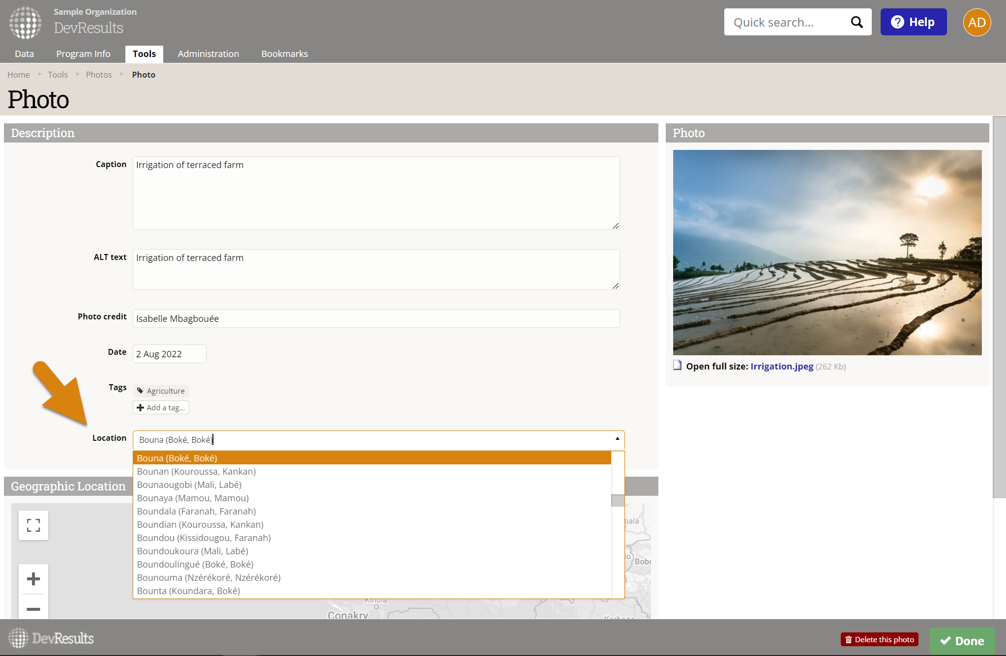
To create this tile, first ensure that the photos you'd like to include on the dashboard are linked to locations.
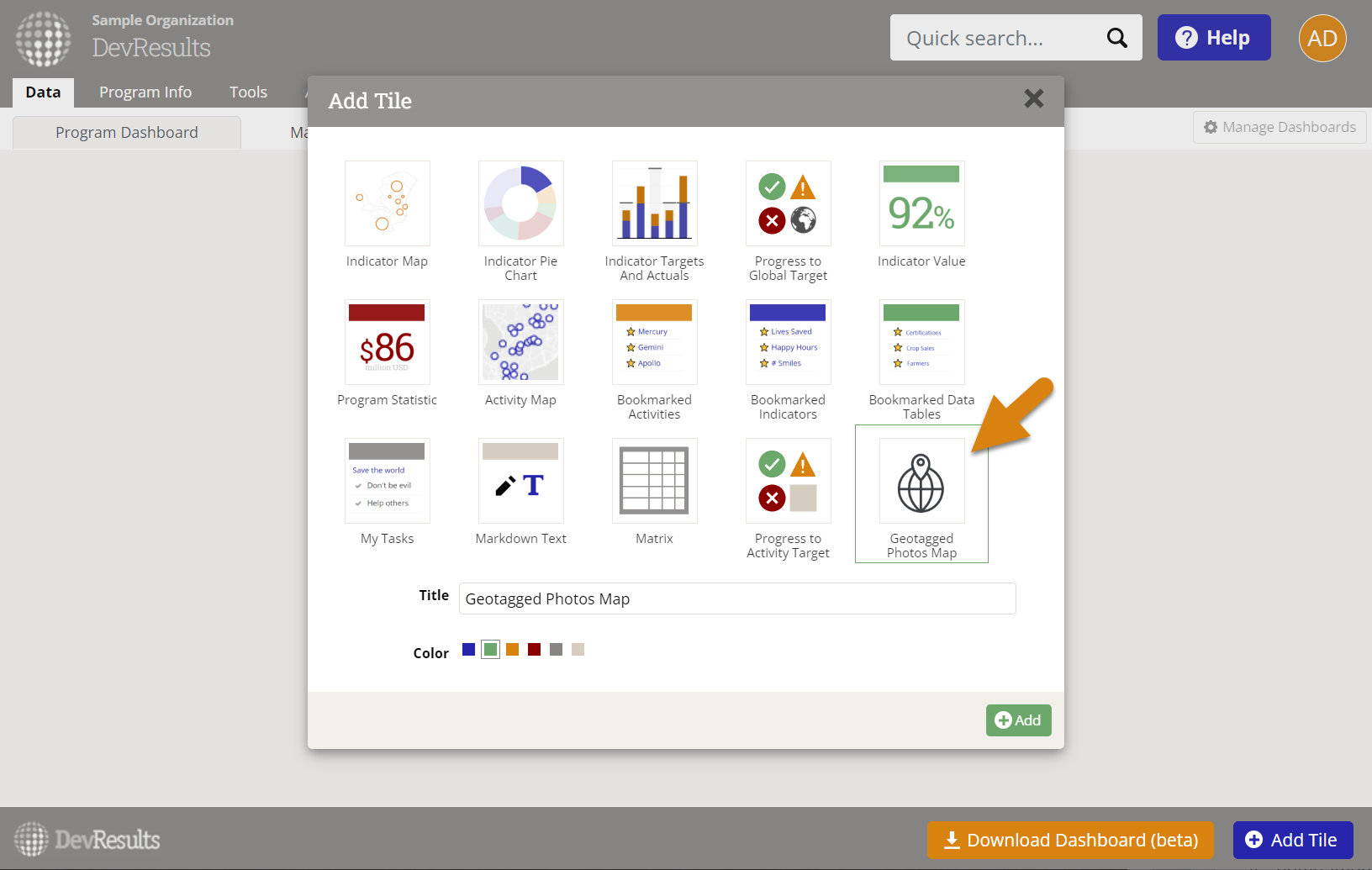
Then, on your dashboard, click Add Tile select the Geotagged Photos Map tile.
To configure the tile, click on the gear icon in the top left of the tile to open the configuration panel.
- In the display section, choose which administrative division level is used to group the photos, the map style, and add desired overlays.
- In the filter section, select which projects' photos are included and for what geographic areas.
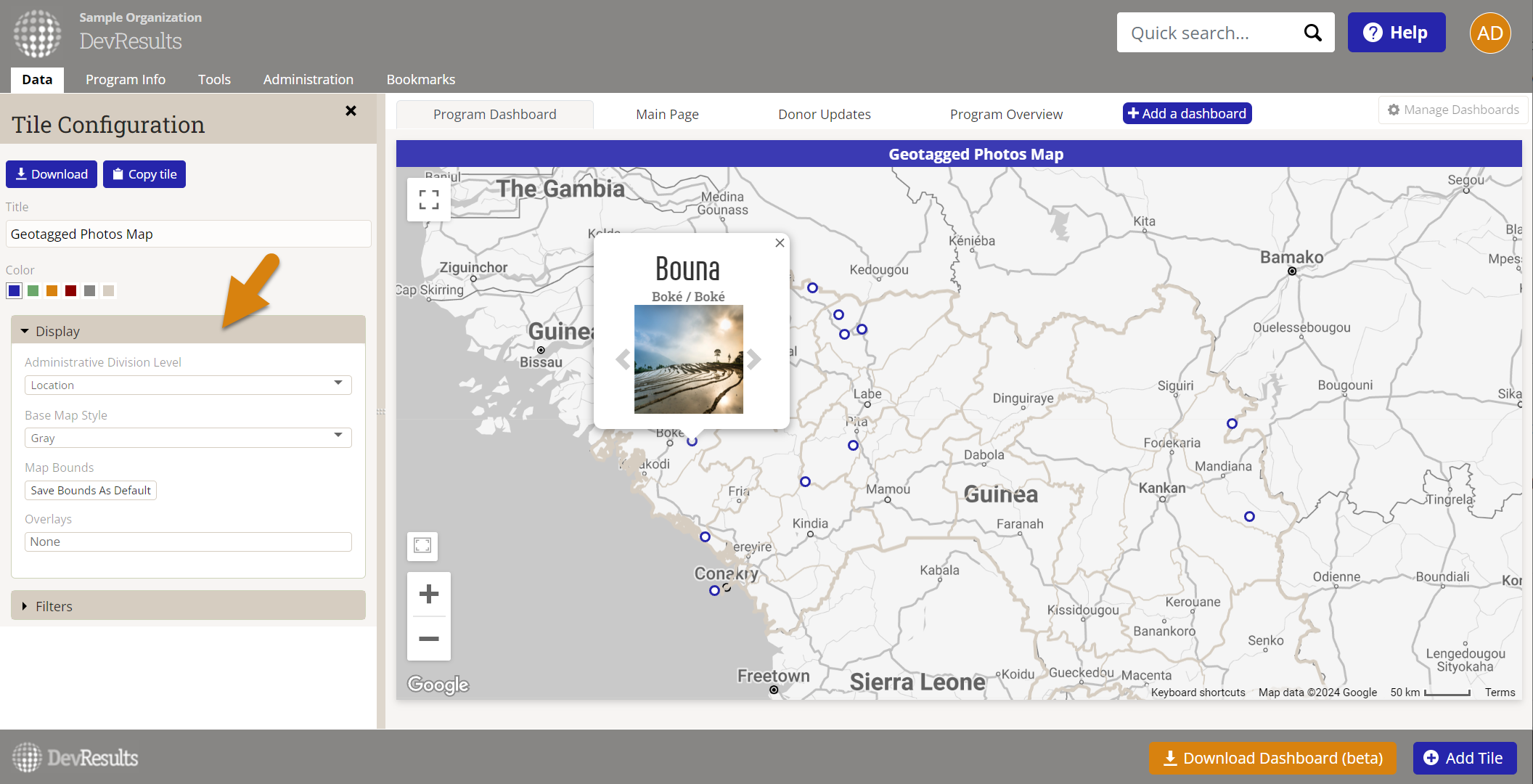
Close the configuration panel and resize the tile as desired.
Didn't answer your question? Please email us at help@devresults.com.