The Goal:
You would like to display additional map features as context for the geographic focus of your work, such as rivers, roads, or conservation areas. You do not need to collect or report data against these features.
The Solution:
DevResults allows you to upload KML files of 2-dimensional map features to your site.
The Details:
KML files contain the code that DevResults reads and displays on maps. DevResults does not offer tools for creating or editing KML files, but you can do so in Google Earth. Often, KML files of useful map features can be found publicly available online.
Who can add map overlays?
Any user belonging to a group with View & Edit permissions on Geographic Information can add map overlays.
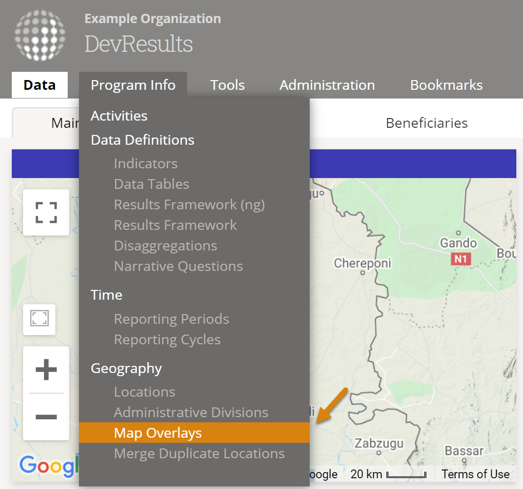
How do I add a map overlay?
Go to Program Info > Geography / Map Overlays from any DevResults page.
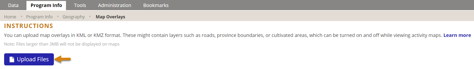
This will open the Map Overlays Index page. Click on Upload Files.
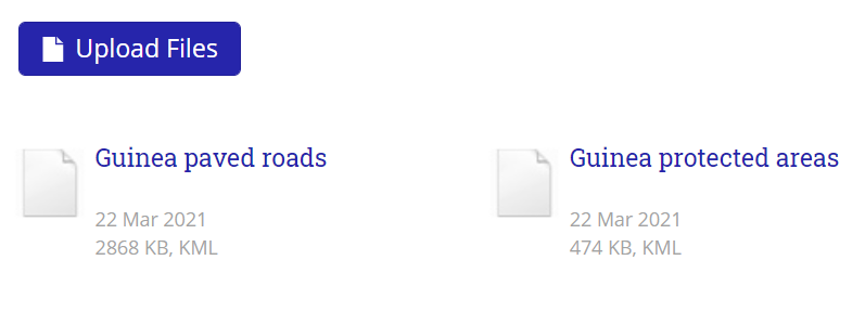
Select the KML file to upload. Once the upload completes, you'll see the file you added:
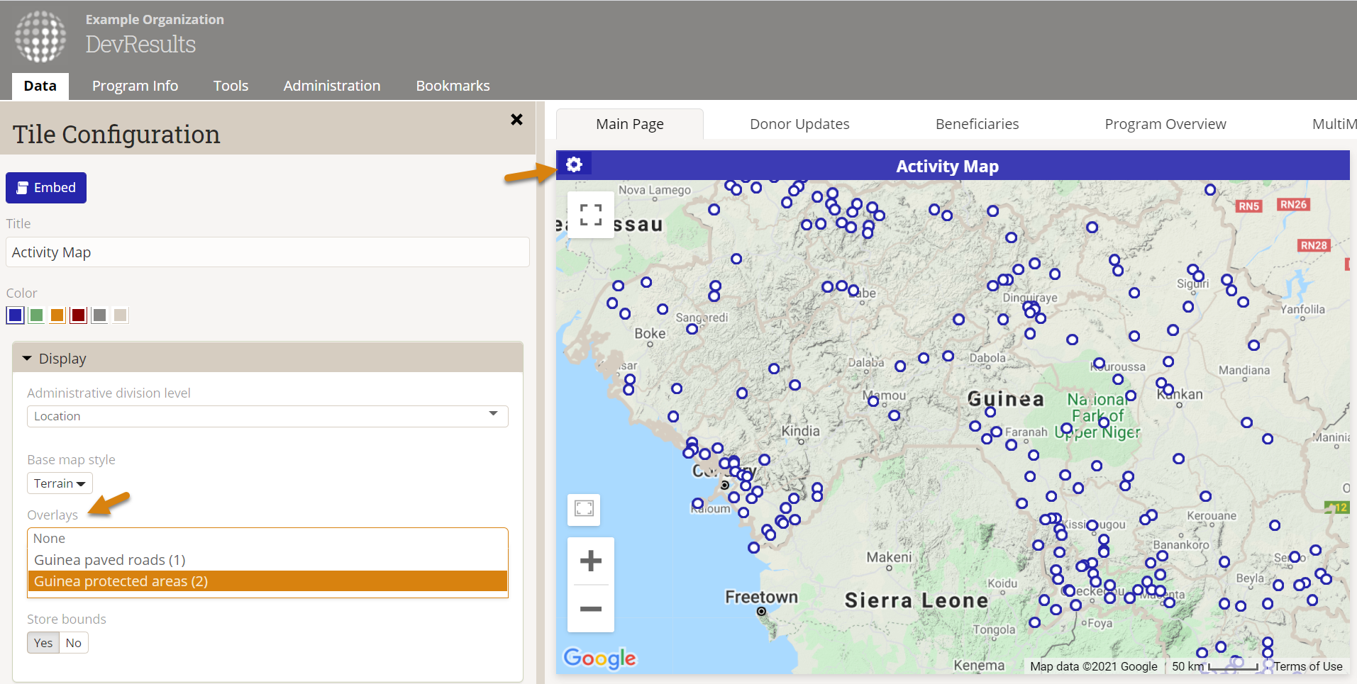
Map overlays can be added to any map in DevResults — map tiles on dashboards, indicator map visualizations, and more — when enabled from the Display panel. To find, the display panel for a map tile on a dashboard, click on the gear or cog icon in the upper left corner of the tile. Your KML file will appear in the list of Overlays. Check the box for your file to display it on the map.
Didn't answer your question? Please email us at help@devresults.com.